
Mount Everest is the highest mountain on Earth, standing 8,849 m (29,032 ft) on the border of Nepal and Tibet. Nepalis call it Sagarmatha, Tibetans call it Chomolungma, and most visitors see it either by trekking into the Khumbu region, flying past it, or climbing it on a full expedition.
Where Is Mount Everest and How Tall Is It?
Everest sits in the Mahalangur Himal range, on the border between Nepal's Sagarmatha National Park and Tibet's Qomolangma National Nature Preserve. Its summit height was jointly re-measured by Nepal and China and announced in December 2020 as 8,848.86 m, generally rounded to 8,849 m. It replaced the older 8,848 m figure used since a 1955 Indian survey.
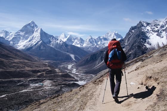
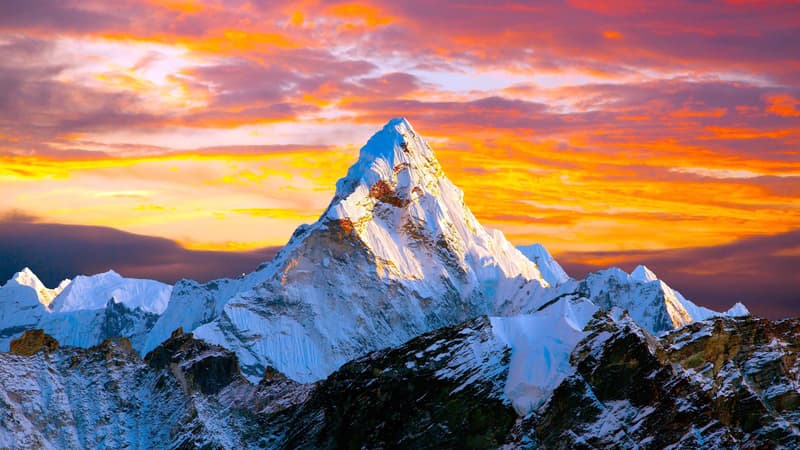
The mountain is part of a cluster of giants visible together from several points in the Khumbu: Lhotse (8,516 m), the fourth-highest peak in the world, sits right next to Everest, with Nuptse, Ama Dablam, Makalu and Cho Oyu nearby. From the ground, Everest's summit pyramid is partly hidden behind Nuptse and Lhotse until you climb above about 5,000 m — which is why Kala Patthar and Gokyo Ri, not Everest Base Camp itself, give the best close-up views.
Everest, Sagarmatha, Chomolungma: Why Three Names?
- Everest — the English name, given in 1865 by the Royal Geographical Society after Sir George Everest, a former Surveyor General of India who never saw the mountain himself.
- Sagarmatha — the official Nepali name, meaning roughly "forehead of the sky," used on all Nepali government maps and permits.
- Chomolungma (also Qomolangma) — the Tibetan name, meaning "goddess mother of the world," used on the Tibet side and by Sherpa communities, who share a closely related language and culture.
All three names refer to the same summit. Nepal's government paperwork — park permits, trekking permits, peak climbing royalties — uses Sagarmatha.
How to See Mount Everest: Four Realistic Options
Most travellers researching "Everest mountain peak" are deciding how close they want to get, how many days they have, and how much walking they want to do. Here is an honest comparison:
| Option | Days | Max altitude reached | Fitness needed | Rough idea |
|---|---|---|---|---|
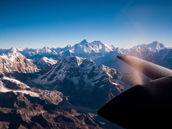
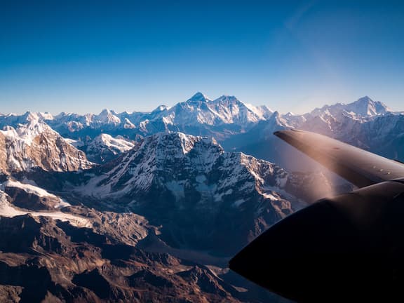
| Everest scenic flight from Kathmandu | Half day | Stay in the aircraft, ~32 km from the summit | None | 1-hour flight, no trekking, no permits |
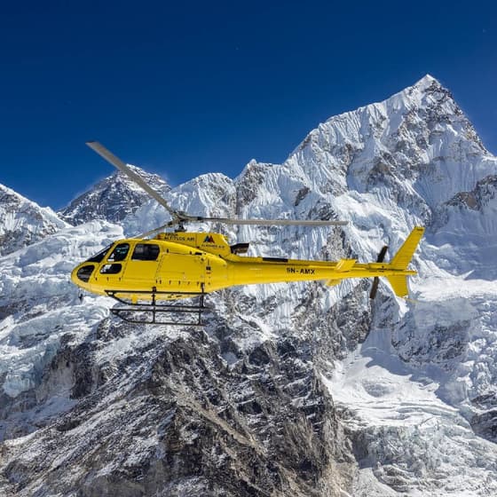
| Everest Base Camp helicopter tour | 1 day | Lands near Kala Patthar, 5,545 m | Low — short time at altitude | Breakfast at Hotel Everest View, back same day |
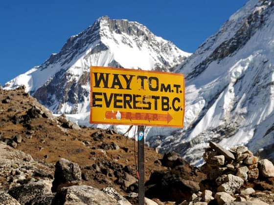
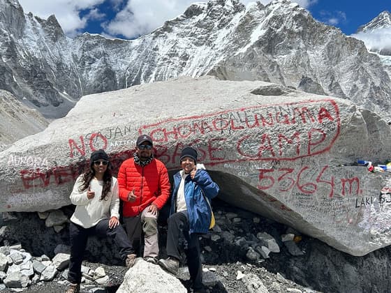
| Everest Base Camp Trek (14 days) | 14 days | Everest Base Camp 5,364 m, Kala Patthar 5,545 m | Moderate-high | The classic walk-in, walk-out route |
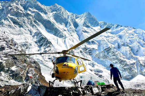
| EBC Trek with Helicopter Return (12 days) | 12 days | Same as above | Moderate-high | Walk up, fly back from Lobuche in 20 minutes |
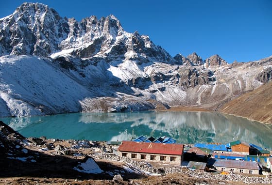
| Gokyo Ri & Everest Base Camp Trek (17 days) | 17 days | Cho La Pass 5,420 m, Gokyo Ri 5,357 m | High | Adds the Gokyo lakes and a pass crossing to EBC |
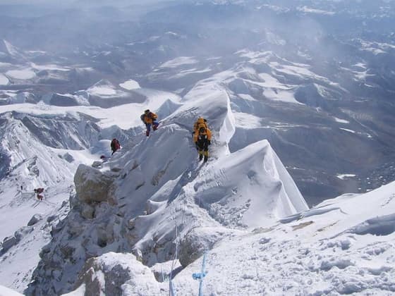
| Mt. Everest Expedition (60 days) | ~60 days | Summit, 8,849 m | Expert climber | Full guided ascent via the South Col route |
If you simply want to lay eyes on the mountain and have a day or less in Nepal, the scenic flight or helicopter day tour do the job. If you want to stand on the trail Edmund Hillary and Tenzing Norgay walked, you need at least 12 days for a trek. Climbing the summit is a different category of trip entirely, requiring years of mountaineering experience, not just fitness.
Can You See Everest From Kathmandu or Pokhara?
No. Kathmandu and Pokhara are too far and too low, and intervening ridgelines block the view. The Pokhara skyline shows the Annapurna and Machhapuchhre massif, not Everest. The closest you can get to Everest without leaving the Kathmandu Valley is a scenic mountain flight, which departs from Tribhuvan International Airport and flies directly along the range. A few Kathmandu Valley hilltops (like Nagarkot) show a sliver of the Everest massif on a very clear day, but it is a distant, hazy silhouette, not the kind of view people search for.
Best Viewpoints of Everest in the Khumbu
If you do trek in, these are the spots where Everest actually dominates the frame:
- Kala Patthar (5,545 m) — the standard viewpoint above Gorak Shep, climbed before dawn for sunrise light on Everest's summit pyramid.
- Gokyo Ri (5,357 m) — above the Gokyo Lakes, with Everest, Lhotse, Makalu and Cho Oyu all visible from one summit. Many trekkers who have done both viewpoints say this view rivals or beats Kala Patthar.
- Hotel Everest View (3,880 m), above Namche Bazaar — the easiest Everest viewpoint, reachable on an acclimatisation day walk.
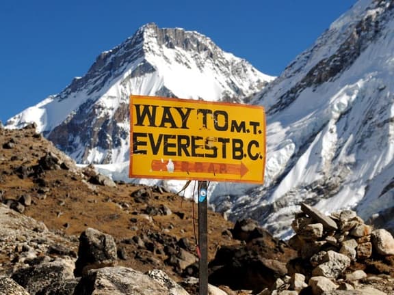
- Everest Base Camp (5,364 m) itself — surprisingly, Everest's summit is barely visible from Base Camp because Nuptse blocks it. People go to Base Camp for the Khumbu Icefall and glacier scenery, not the best photo of the summit.
- Pikey Peak (4,065 m) — a quieter, lower-altitude viewpoint southwest of the main trail, popular with trekkers short on time; see the Pikey Peak Trek.
Best Time to Trek to or Fly Past Everest
Two windows work well for both flying and trekking:
- Spring: March to May — warming temperatures, rhododendrons in bloom at lower elevations, generally stable mornings for flights and clear afternoons building cloud. This is also the main Everest climbing season.
- Autumn: late September to November — the most reliable weather of the year, post-monsoon clear skies, the busiest season on the trails.
- Winter: December to February — cold but often very clear mornings, fewer crowds, passes like Cho La can be snowbound and harder to cross.
- Monsoon: June to August — frequent cloud, rain at lower elevations, snow up high, and a real risk of flight delays; mountain views are unreliable.
For scenic flights specifically, early morning departures in any season give the clearest air before afternoon cloud builds over the Himalaya.
Getting to the Everest Region: The Lukla Flight Rule to Know
Almost every Everest trek starts with a flight to Lukla (2,860 m), one of the world's shorter and more dramatic mountain runways. During the two busy seasons — March to May and September to November — Nepal's aviation authorities route Lukla flights through Ramechhap's Manthali Airport instead of Kathmandu, to ease congestion at the capital's single runway. Manthali is roughly 4 to 5 hours from Kathmandu by road, so HSJ schedules a 1–2 a.m. departure to reach the airport in time for the first morning flights. Outside peak season, flights run directly from Kathmandu and take about 35 minutes. Always confirm current routing with your operator close to your travel dates, since the rule has shifted in past years.
Permits and Fees for the Everest Region
Independent trekkers and guided groups both need two permits to walk in the Khumbu:
- Sagarmatha National Park entry permit — required for anyone entering the park above Monjo; check current fees on the Department of National Parks and Wildlife Conservation site before you travel, as rates are periodically revised.
- Khumbu Pasang Lhamu Rural Municipality entry permit — a separate local permit collected at Lukla or Monjo, which functions in place of the old TIMS card for this specific region.
A TIMS card is not used inside the Khumbu because the local municipality permit replaced it there, but Nepal has tightened rules elsewhere requiring trekkers to go through a registered agency or licensed guide in many areas — see the Nepal Tourism Board for the latest visa and trekking regulations, and your home government's travel advice (for example the UK Foreign Travel Advice for Nepal) for safety and insurance guidance before booking.
For anyone planning an actual climb of the summit rather than a trek to base camp, Nepal's Department of Tourism issues a separate mountaineering permit and royalty for Everest, priced far higher than trekking permits and subject to change — confirm the current figure directly with the Ministry of Culture, Tourism and Civil Aviation before committing to an expedition.
How Hard Is It to Trek Near Everest?
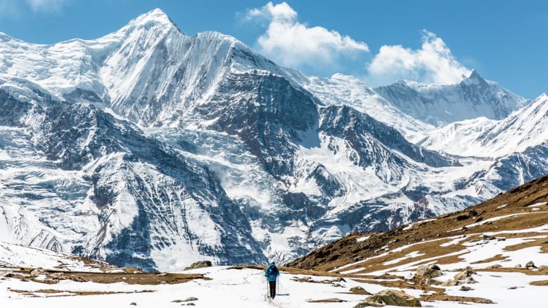
You do not need climbing skills to reach Everest Base Camp, Kala Patthar or Gokyo Ri. You do need:
- A reasonable base fitness — regular hiking or cardio training for a few months beforehand.
- Time for acclimatisation — proper itineraries build in rest days around 3,440 m (Namche) and 4,410 m (Dingboche) before pushing higher.
- Tolerance for teahouse conditions — basic rooms, shared bathrooms at higher altitudes, and simple meals.
- A plan for altitude sickness — know the symptoms, and trek with a guide trained to recognise them.
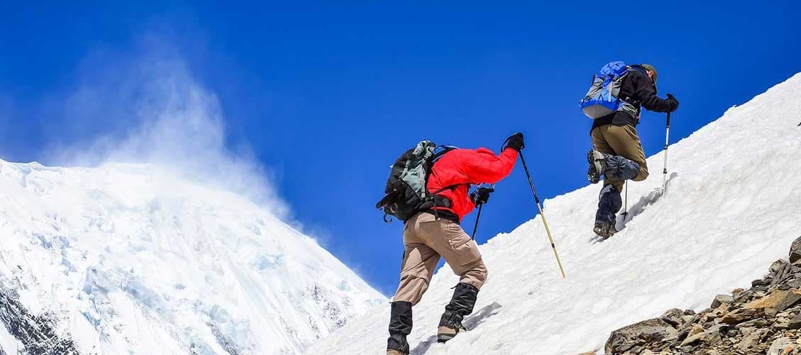
Crossing Cho La Pass (5,420 m), as the Gokyo and EBC combination route does, adds a harder day: a pre-dawn start, a steep rocky climb and a short glacier crossing where micro-spikes are used in colder months. It is not technical climbing, but it is a serious trekking day and not recommended for first-time high-altitude trekkers without good preparation.
Climbing Mount Everest: The Short Version
Standing on Everest's actual summit is a mountaineering expedition, not a trek. The standard route is the South Col route from the Nepal side, climbed over roughly 60 days including acclimatisation rotations through base camp and the higher camps. Climbers need prior experience on other peaks, a strong guiding team, supplemental oxygen above the South Col, and a six-figure budget once permits, guiding, oxygen, logistics and insurance are added up. HSJ runs the Mt. Everest Expedition (South, 8,848 m) for climbers who already have the mountaineering background this route demands; it is not an extension of a trekking holiday.
For everyone else — the vast majority of travellers who search "Everest mountain peak" — a trek to Base Camp, a Gokyo Ri sunrise, or a one-hour scenic flight delivers the view and the experience without the expedition-level commitment.
Choosing Your Everest Trip
A short way to think about it:
- Only a day or two in Nepal, want to see Everest: take the Everest scenic flight or a helicopter day tour.
- Two weeks, want the classic walk: the 14-day Everest Base Camp Trek.
- Limited days off work, don't want to walk back down: the EBC Trek with Helicopter Return, 12 days.
- Want the quieter valley and the best mountain panorama, with time to spare: the Gokyo Ri & Everest Base Camp Trek, 17 days, crossing Cho La Pass in both directions of the comparison. A faster version with a shared helicopter return from Gorak Shep is also available — ask HSJ for current dates.
- Want every pass in the Khumbu: the Everest Three Passes Trek, 19 days, which adds Kongma La and Renjo La to the Cho La crossing.
- Want to actually climb it: years of mountaineering experience first, then a full expedition booking.
Browse the full range of routes in the Everest region, or look at peak climbing options like Island Peak or Lobuche Peak if you want technical climbing experience before attempting an 8,000 m mountain.
Frequently asked questions
How tall is Mount Everest? Everest stands 8,849 m (29,032 ft) above sea level, based on the 2020 joint Nepal-China survey. Is Everest in Nepal or Tibet? Both. The summit sits exactly on the Nepal-Tibet (China) border, with the main climbing and trekking routes approaching from the Nepal (south) side via the Khumbu. Can beginners trek to Everest Base Camp? Yes, with preparation. No technical climbing skill is required, but you need solid fitness, a few months of training, and an itinerary with proper acclimatisation days, ideally with a licensed guide. Do I need a permit to trek in the Everest region? Yes — a Sagarmatha National Park entry permit and a Khumbu Pasang Lhamu Rural Municipality permit, both arranged at the start of the trek. A TIMS card is not used in this specific region. What is the fastest way to see Everest without trekking? A one-hour scenic mountain flight from Kathmandu, or a day-long helicopter tour that lands near Kala Patthar for breakfast with mountain views. When is the best time to see Everest clearly? Late September to November and March to May, when skies are generally clearest; early morning is best for flights in any season. How tall is Mount Everest?
Everest stands 8,849 m (29,032 ft) above sea level, based on the 2020 joint Nepal-China survey.
Is Everest in Nepal or Tibet?
Both. The summit sits exactly on the Nepal-Tibet (China) border, with the main climbing and trekking routes approaching from the Nepal (south) side via the Khumbu.
Can beginners trek to Everest Base Camp?
Yes, with preparation. No technical climbing skill is required, but you need solid fitness, a few months of training, and an itinerary with proper acclimatisation days, ideally with a licensed guide.
Do I need a permit to trek in the Everest region?
Yes — a Sagarmatha National Park entry permit and a Khumbu Pasang Lhamu Rural Municipality permit, both arranged at the start of the trek. A TIMS card is not used in this specific region.
What is the fastest way to see Everest without trekking?
A one-hour scenic mountain flight from Kathmandu, or a day-long helicopter tour that lands near Kala Patthar for breakfast with mountain views.
When is the best time to see Everest clearly?
Late September to November and March to May, when skies are generally clearest; early morning is best for flights in any season.